
During the week of October 10-14, the city of Laxenburg (Austria) will host the Earth Observation workshop meeting ConnectinGEO and ENEON Workshop Week. In the first of two workshops, initial results of the ConnectinGeo project will be presented, while the second will cover ENEON’s completed work and upcoming activities. Both projects are led by CREAF.

CREAF coordinates the European project ConnectinGEO, led by Joan Masó and Ivette Serral. The project, begun in February 2015 and with a total duration of two years, aims to put European Earth Observation (EO) institutions and actors into closer contact and coordination. During the 10th and 11th of October 2016, the headquarters of the International Institute for Applied Systems Analysis (IIASA) in Laxenburg will host the first of two workshops, the Earth Observation gaps and prioritization actions’ Workshop. “The European Commission wanted to know which areas of EO are receiving to many resources and which are left on the sidelines. The detection of these gaps or deficiencies in the system, known as gap analysis, was a primary objective of ConnectinGEO,” explains Ivette Serral. Along these lines, this first workshop will be dedicated to presenting the results of the gap analysis carried out in the project. She adds, “we will also present the order of priority with which we think these gaps should be addressed and tackled.”
As a strategy for undertaking the gap analysis, the creation of a European Network of Earth Observation Networks (ENEON) was proposed with the idea that this new network would facilitate its execution. Originating from ConnectinGEO, this network helps visualize and understand the relationships among different European Earth Observation institutions. ENEON will therefore be the focus of the second workshop at IIASA in the same week, on the 12th and 13th of October, titled ENEON Workshop and Plenary. Project partners would like ENEON to continue after the end of ConnectinGEO in February 2017. Towards this goal, Serral explains that in the workshop “we want to put on the table the question of how ENEON should be structured from here forward, what can be done in the future, what economic support will be necessary and where to ask for it, and what work groups it should have.”.

A workshop is a seminar where participants other than the organizers can also engage actively in the debate. Serral says, “our intention is to have an exchange of ideas between the different EO representatives and actors and that this serves for improving and enriching the results of ConnectinGEO and facilitates the solitary start of ENEON [after ConnectinGEO has finished].” For this reason, attendance to the meetings is open to anyone, and with previous notification to the organizers it is possible to participate as a speaker.
The Objectives of Sustainable Development and Essential Variables
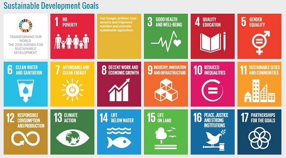
In order to carry out the gap analysis the researchers first had to define the most important topics within the field of Earth Observation. The ConnectinGEO team did this by basing their analysis on two factors. Firstly, the UN has established Sustainable Development Goals (SDG) for the year 2030. The SDG are transversal objectives, covering all human activities, which according to Ivette “people working in Earth Observation (be it via satellite images or field measurements) can help achieve.” Secondly, in certain branches of the science such as climatology or studies of biodiversity, there exist what are known as essential variables: basic components of a system which are crucial for understanding its functioning. For instance, temperature, rainfall, and wind are essential variables in climatology.
Beginning with these SDG and essential variables, the participating partners of ConnectinGEO were able to identify gaps in the EO networks. “Redundancies will begin to appear when many resources are allocated to the same kind of study or indicator. There will also be undervalued areas which go unstudied if not enough resources are dedicated, and in such a situation we can only cover a part of the SDG and essential variables,” says Serral.


